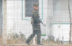
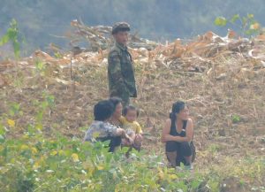
In mid-October, ASIAPRESS visited the New Yalu River Bridge and the Hwanggumpyong Development Zone. Both are located on the lower reaches of the Yalu River, which forms the border between North Korea and China. Ten years after its completion, the bridge is still not open. The development zone is abandoned and desolate. (HONG Mari)
[Photo 1] The New Yalu River Bridge, still unopened even 10 years after completion. Photographed by HONG Mari in October 2024.
◆ Barbed wire and a "North Korea" sign in the middle of the bridge
Sinuiju in North Pyongan Province (North Korea) and Dandong (China) are trading cities. They have the largest volume of trade between North Korea and China. The Yalu River Bridge was built in 1943 during the Japanese colonial period. The construction of a new bridge was agreed upon in late 2010 due to the bridge's age and the need to accommodate increased logistics between North Korea and China.
ASIAPRESS confirmed that construction was progressing smoothly during visits to the site in 2011 and 2012. At the time, the mayor of Dandong, Zhao Liansheng, told Chinese media: "China has borne the total construction cost of 1.7 billion yuan (about 204 million US dollars or 282 billion Korean won at the time).
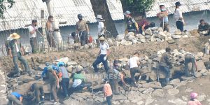
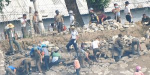
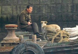
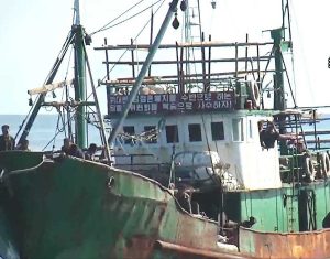
[Photo 2] North Korean work boats during the construction of the New Yalu River Bridge. Photographed by ASIAPRESS in May 2011. [Photo 3] The New Yalu River Bridge under construction. Work on the pontoon bridge foundation was in full swing. Photographed by NAM Jung-hak in March 2012.The New Yalu River Bridge is 3,000 meters long. It was completed in 2014. However, it has remained unused and unopened to the present day. There have been several media reports that it might be opened this year, as this year marks the 75th anniversary of the establishment of diplomatic relations between North Korea and China. However, there were no signs of this at the site.
On the day ASIAPRESS visited the area, a single vehicle was seen driving up to the middle of the bridge, where barbed wire blocks passage, and several people were observed looking toward the North Korean side.
[Photo 4] Barbed wire blocks the center of the New Yalu River Bridge. A sign indicating there is a North Korean controlled area ahead is visible. Photographed by HONG Mari in October 2024.◆ Heavily promoted project remains untouched
The Hwanggumpyong Development Zone is located about 10 minutes downstream from the New Yalu River Bridge on the North Korean side. Hwanggumpyong was originally a North Korean sandbar in the Yalu River that has been connected to China through the accumulation of sediment. In June 2011, a groundbreaking ceremony for a special economic zone was held. Over 1,000 people attended, including Jang Song-thaek, vice chairman of the National Defense Commission and Kim Jong-il's brother-in-law. It was heavily promoted as a model case of economic cooperation between North Korea and China.
[Photo 5] Large billboard showing the concept plan for joint North Korea-China development of the Hwanggumpyong area. It shows plans to develop the entire area up to downtown Dandong. Photographed by NAM Jung-hak in March 2012.However, there has been no information or evidence of a resumption of development since that time. As of October 2024, it remains untouched and abandoned.
[Photo 6] North Korea-China entry gate to the Hwanggumpyong Development Zone. Photographed by ISHIMARU Jiro in July 2017. [Photo 7] Current North Korea-China entry gate to the Hwanggumpyong Development Zone. The second sign from the left warns: "Military Management Zone. Under Surveillance (Camera). Photography Strictly Prohibited. Violators Will Be Investigated." Photographed by HONG Mari in October 2024.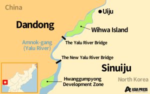


![[Photo Breaking News] Multiple Russian Vehicles at N.Korea-Russia Border, Including Unidentified Cargo (6 photos) [Photo Breaking News] Multiple Russian Vehicles at N.Korea-Russia Border, Including Unidentified Cargo (6 photos)](https://www.asiapress.org/rimjin-gang/wp-content/uploads/2024/10/01-2024-10-22-16.31.49_776ccf74-90x65.jpg)


